For Savoie and Northern French Alps
A stormy week ahead with snowfall!
Expect a period of snowy unsettled weather, with significant snowfall. Some days this may be just a few cm, but next week it will become quite widespread even down to 1500 m. One snow report, for example, suggests up to 51 cm at the higher altitudes in Val d’Isère over the next few days. The biggest risks will be N facing shady slopes above 2400m
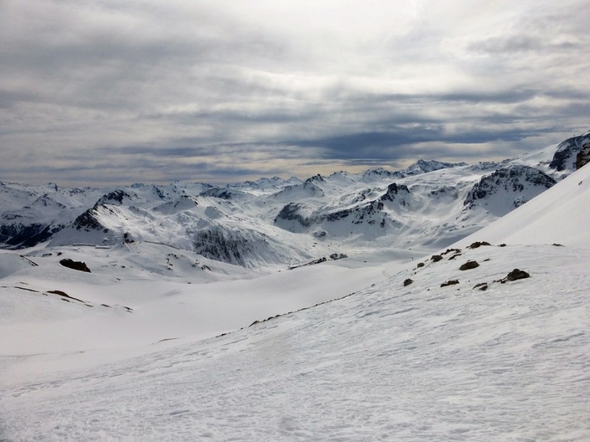
Over the past week, we’ve been finding varying off-piste conditions, with the wind and sun playing a big part. We didn’t receive as much fresh snowfall as we’d expected and hoped for.
Flat light conditions will prevail, making route-finding tricky in the off-piste, but there will be some bright spells too. Fresh snow will always improve skiing conditions, especially at higher altitudes. However, it will also be accompanied by wind, meaning significant snow accumulations will be forming, as well as windslab.
Sunny slopes, and those below 1800 m or so have recently become very humidified by day, refreezing overnight, so becoming very solid and crusted first thing in the morning.
On shaded North’ish facing slopes above 2400 m or so, the snow has recently been colder, drier, and pleasant to ski than on the sun-affected and lower altitude slopes. These high shaded N slopes, will become unstable if they get more than 20cm of new snow on them. That’s because the snow has become cohesionless in many places on these colder slopes, during a protracted period of colder temperatures and clear skies. See our previous blog for more on this, and an interview (in French) with avalanche expert, Alain Duclos, explaining his very real concerns in the Dauphiné Liberé.
Guiding earlier this week, Henry found ‘patches’ of unconsolidated sugary snow – technically known as very well-developed facets – on shaded slopes especially above 2200 m, particularly where the snowpack was 50cm or less deep. The size of the ‘patches’ ranged from a few square m to 100 square m. The ‘patches’ were mostly in between areas of hard wind-blown snow and generally crusty snow (not sun crusted because we are talking about N’ish shaded areas). They were mostly away from the classic off-piste itineraries that have been packed down by skiers over the last few weeks of no new snow.
Off-piste weather forecast for 7 to 15 March
THURSDAY 7 MARCH
Mountain conditions improve with the end of the Foehn storm (last gusts at 80 km / h in Tarentaise). The sky remains well covered in clouds with snowfall at 1600-1800 and 1200 meters till 12h (quantities close to 5 to 15cm to 2000 meters). In the afternoon, the sky clears a little but many cumulus clouds on the slopes and small flurries. Maximum temperatures (this morning): +10 to 1000 meters, 0 to 2000 meters and -6 to 3000 meters, they drop during the day.
0 ° C: down to 1600 meters.
-10 ° C: down to 3100 meters.
Wind at 2500 m:
Wind at 4000 m: South 100 to 140 km / h then southwest 40 to 70 km / h.
THURSDAY EVENING AND NIGHT
The conditions in the mountains improve with a return of some clearings in the valleys, the summits remaining a little covered with a dryweather. The wind is weak in altitude. Minimum temperatures to +1 at 1000 meters, -5 to 2000 meters and -11 to 3000 meters. In plain, overcast and +4 degrees.
FRIDAY, MARCH 8
The conditions in the mountains remain calm and with a few periods of clearings in the morning then the clouds gain from the West and give small snow flurries at 1200-1400 meters approximately (quantities close to 2 to 5cm towards 1500 meters). Winds from West to South-West blow at 30 km / h on the summits.
0 ° C: about 1600 meters.
-10 ° C: around 3100 meters.
Wind at 2500 m: West at South-West 15 to 30 km / h.
Wind at 4000 m: West at Southwest 40 to 60 km / h.
SATURDAY 9
Little sun, less cool in the afternoon in the mountains. The cloud cover thickens a bit, hanging the massifs. Scattered showers become widespread in the early morning, intensify a little in the late morning; they persist in the evening on the north of Savoie, then weaken, and disappear at the end of the night; they do not touch the Haute Maurienne.
Snowflakes can rise above 1500-2000 m during the day; at night can descend to 1100 m; above 2300 m, less than 10 cm is expected in Haute Maurienne, but 20-50 cm elsewhere.
The strong wind from NW to WNW in very high mountains generates strong gusts downwind of the Glaciers de la Vanoise and the Italian border.
In the lower mountain, the wind of SW then WNW is sometimes strong during the day, then weakens at night.
Isotherm 0 ° C: 1800 then 2300 m daytime, 2200 then 1900 m evening and night.
SUNDAY 10 and MONDAY 11
West winds at altitude, hardly slow while turning to the NNW. On Sunday, the sky quickly covers in the morning, bringing widespread snow above 1500m; thunderstorms and showers follow in the night.
Monday, thunderstorms, and showers, easing in the night.
The snow above 1500 m in the morning, then lowers into the valleys Monday.
The 0 ° C isotherm rises the following night.
TUESDAY 12th and WEDNESDAY 13th
Weather streams from the NW then turns to the WSW, then slows down by turning back to the NW.
Tuesday, a little sun, and a few scattered showers; they become widespread and intensify the following night.
Wednesday, sunny and snow.
The 0 ° C isotherm rises a little above 1500 m Tuesday in the morning, then goes down again.
It snows at least to the lower valleys.
THURSDAY 14 and FRIDAY 15
The NW weather stream remains fast.
Numerous clouds and precipitation.
Isotherm 0 ° C up to 1500 m.
It’s snowing lower. Cumulative snow can be significant in the mountains.
Tip of the week
Keep checking the avalanche bulletins as and when we get any fresh snowfall. In particular look for mentions of the stability of the snowpack and any weaknesses observed.
If we receive any fresh snowfall of more than 20 to 30 cm proceed cautiously and start off on slopes of 30° steepness or less unless you really know what you’re doing. Remember: the bigger the avalanche, the more vicious it is! Be particularly wary around those high N facing slopes with the sugary snow underneath any freshly fallen snow.